On Budget - On Schedule - On Spec
HOME
J & J Survey, LLC began the business of Professional Land Surveying in December 2010. We are licensed in the States of Kansas, Missouri and Nebraska and have MBE, DBE and WBE certifications. J & J Survey, LLC is owned by John B. Young, PLS.
John has been surveying since 1984 throughout Kansas and Missouri for Commercial, Industrial and Residential Properties.
Land surveying is the process of measuring and mapping the physical features of a piece of land, including its boundaries, elevation, and other characteristics. It involves using specialized tools and techniques to gather accurate data about the land, which can then be used for a variety of purposes.
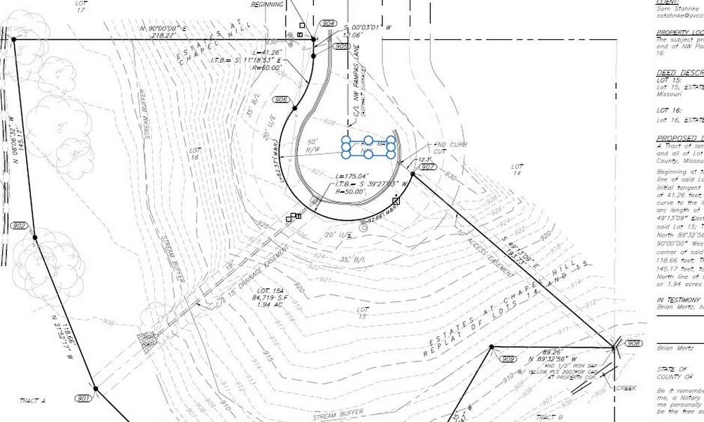
Boundary Survey
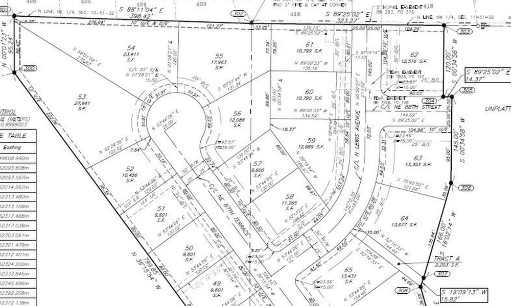
Subdivision Plat of Survey
Boundary Line Adjustment
ALTA/NSPS Land Title Survey
Lot Split Survey
Architectural - Topgraphic Survey
Lot Consolidation Survey
Flood Plain Surveys
YEARS OF COMBINED EXPERIENCE IN LAND SURVEYING
CUSTOMER SERVICE IS FIRST RATE
GOOGLE RATING CUSTOMER SATISFACTION OUT OF 5.0
Land surveying is important for a number of reasons. For example, it can be used to help property owners establish boundaries and resolve disputes with neighbors. It is also used in construction projects to ensure that buildings and other structures are built in the right location and to the correct specifications. Additionally, land surveying is used in environmental monitoring and management, as well as in the development of maps and other geographic information systems.
Residential

New Construction

Streets & Highways

Parks and Trails

We are experts in performing property line surveys, topographic surveys, ALTA/NSPS Land Title Surveys and we are proficient in construction staking for contractors throughout the Kansas City area. Commercial Parcels, Real Estate Development, Highways-Roads-Bridges, Retail Development, Re-purposed Land Use, Construction Staking, Drainage Projects…


J & J Survey, LLC
8680A N. Green Hills Rd
Kansas City, MO 64154
Call (816) 741-1017


